Bøsdalafossur, Faroe Islands: Hiking to the Lake Above the Sea
Lake Sørvágsvatn spills over a basalt cliff straight into the North Atlantic at Bøsdalafossur. Here's what the hike actually involves, including the entrance fee, the terrain, and whether it's worth your time.
What makes Bøsdalafossur worth the hike
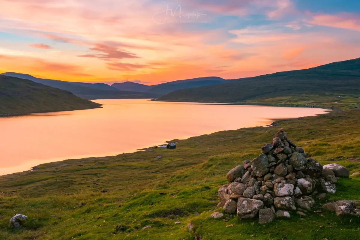
Bøsdalafossur in the Faroe Islands sits on the western edge of Vágar. I struggled to describe it properly after I first visited. Lake Sørvágsvatn, the largest lake in the archipelago, spills over a basalt cliff and drops straight into the North Atlantic. The waterfall looks almost staged, like someone built it for a film. Green mountains crowd in on all sides and the coastline just keeps going until it disappears.
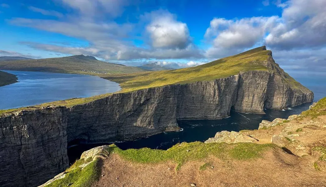
The waterfall is only part of what makes this place strange and memorable. The hike traces the edge of a lake that, from the right spot at the Trælanípa viewpoint, looks like it is hovering hundreds of metres above the sea. It is a genuine optical illusion and it messes with your head in the best way. Photos of it have circulated on social media for years, but standing there yourself is different. The scale is off. Your eyes tell you one thing and your brain another. The landscape feels remote and bare. Basalt cliffs rise on every side. Most days you will share the trail with maybe a handful of other hikers, if any at all.
The Bøsdalafossur hike: what to expect
The hike to Bøsdalafossur is mostly straightforward, but there are a few things first-timers should know. The full loop takes about two hours at a steady pace. Faster walkers do it in closer to 90 minutes. If you stop at every viewpoint, which you absolutely should, it can stretch into a half-day trip.
Getting started: Miðvágur to the trailhead
The hike starts near Miðvágur. A sign that reads "Lake above the Sea" points you to the parking area. The original trailhead closed because of bird disturbance, so everyone now uses the Trælanípa trailhead instead. Parking is at 62°02'31.7"N 7°11'57.2"W. From the car park, the first stretch is flat, well marked, and hard to get wrong. It follows the shore of Lake Sørvágsvatn on a gravel path still being improved. This opening section is genuinely easy for anyone, regardless of age or fitness.
This is also where you pay the 200 DKK entrance fee (roughly $28 USD or £23 GBP). The landowner describes it as a maintenance contribution. You can pay cash or card at the trailhead. Whether the fee is justified depends on how you look at it. The path does need upkeep, and maintaining a trail in a place this remote is not cheap. Some hikers have found the caretaker flexible. On quiet days, the caretaker has let people return later the same week at no extra charge. A cup of coffee is included, which on a windy Faroese day is genuinely welcome.
Trælanípa viewpoint: the lake above the ocean
About halfway along, the trail climbs gently toward the Trælanípa viewpoint. This is where things get strange in the best way. The guide map handed out at the entrance marks three distinct viewpoints, each giving a slightly different angle on what has become the defining image of this hike: Lake Sørvágsvatn looking like it floats above the Atlantic, perched on the edge of the world.
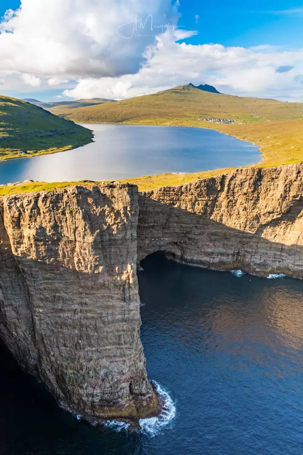
The climb to the viewpoints is uphill but short, and it is absolutely worth it. The Trælanípa cliff gives you fantastic photo opportunities. On a clear day the panorama is genuinely hard to take in all at once. Even on grey afternoons, the drama of those basalt cliffs, the endless ocean, the stillness of the lake. It all holds.
One thing worth knowing: those famous social media photos showing the lake soaring high above the sea are almost always shot from a drone. The lake sits about 20 to 30 feet above sea level at its closest point to the cliff edge. The optical illusion from Trælanípa is real and it is striking, but it helps to know the actual scale of the drop before you go.
Getting to Bøsdalafossur waterfall
From Trælanípa, the Bøsdalafossur waterfall lies ahead, but this is where the trail changes completely. The maps show a loop connecting the viewpoint to the waterfall. In practice, there is no marked trail between them. Once you leave the maintained path, you are walking across soft, spongy ground with no clear route. The terrain is rocky, uneven, and when wet it gets dangerously slippery. Some sections involve scrambling over rocks. The final approach to the waterfall is not easy.
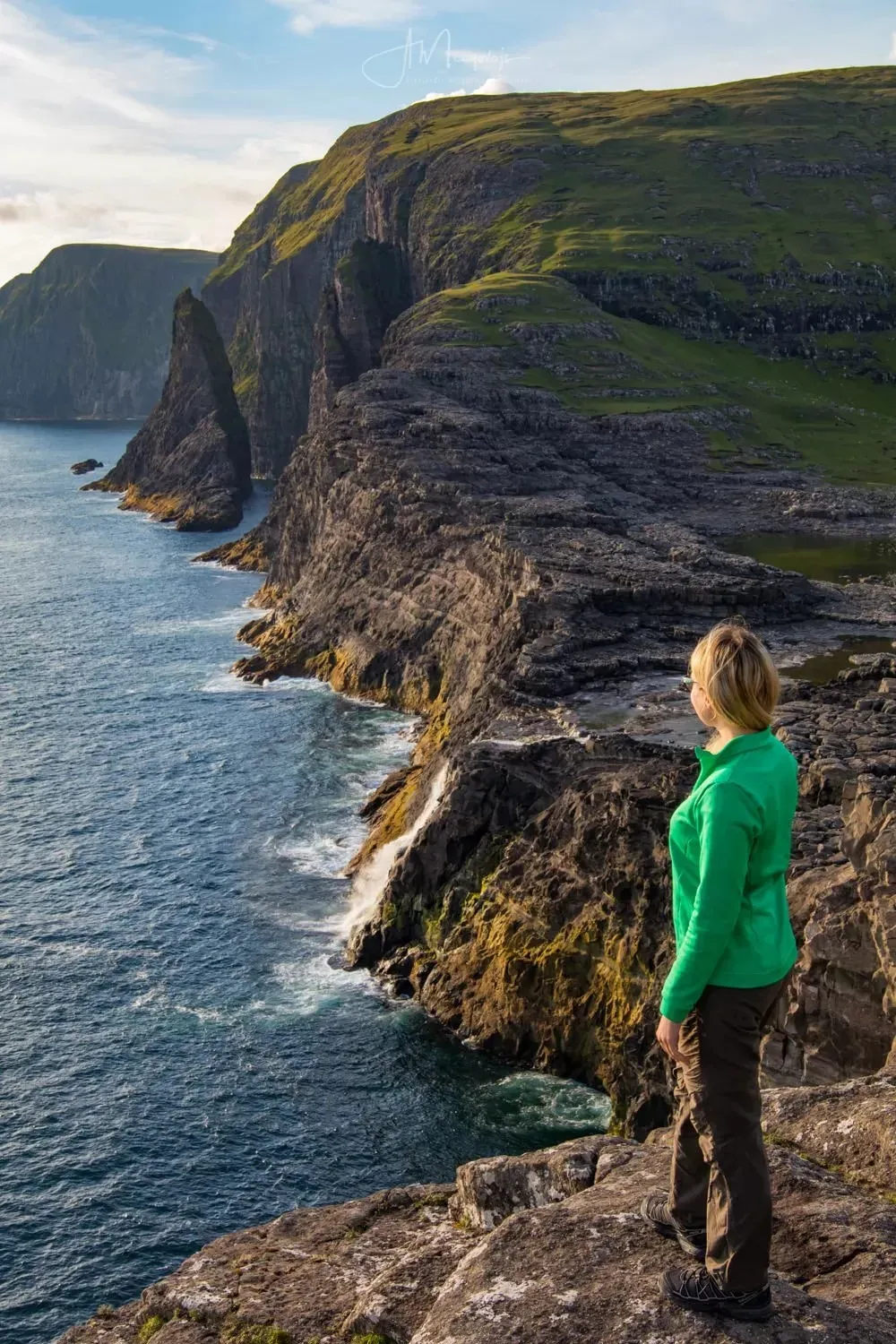
Despite the lack of a formal trail, getting lost is unlikely. The area is open and fairly flat, and you can see the main path from almost anywhere. Google Maps does not show the terrain here, which can be disorienting, but following the cliff edge westward will eventually get you to the waterfall.
The waterfall divides opinion. It is not a thundering cascade on the scale of Iceland's big falls. It is a relatively modest drop, and when the lake water is low the flow feels underwhelming. After heavy rain, though, it swells into something far more dramatic. Either way, the real draw is not just the falling water but the whole scene: the waterfall plunging into the sea, the green cliffs on both sides, waves hitting the rocks below, and the sheer amount of space and quiet.
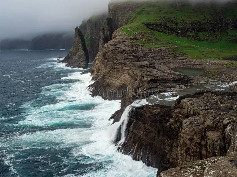
If you are more adventurous, there are hidden spots on the far side of the lake. Reaching them means leaving any kind of trail behind and dealing with slippery rocks and some minor climbing. It is rough going, but weirdly inviting if you enjoy off-trail wandering. Having the place entirely to yourself, which is genuinely possible outside peak times, adds something that crowded attractions simply cannot offer.
Practical tips for hiking Bøsdalafossur
The 200 DKK entrance fee: what you are paying for
No part of this hike gets more discussion than the entrance fee. Any Bøsdalafossur Faroe Islands guide has to address it. You pay 200 DKK per adult at the trailhead parking area. The landowner describes it as a maintenance fee. You can pay by card or cash.
Reactions vary. Some hikers think it is steep for what amounts to a 40-minute walk each way on a partially gravelled path. A student discount would open the experience to younger travellers, and that seems like a fair point. Others note that maintaining a trail in the Faroe Islands, with relentless weather and fragile ground, is genuinely expensive. The fee directly funds upkeep of a path that would otherwise degrade into an impassable bog. Coffee is included. On busy days, the fee helps manage numbers on sensitive land. Whether it feels like good value depends on the weather, who you are with, and how you feel about paying to access nature. But letting the fee ruin the experience would be a mistake. Life is short and the views are too good.
What to bring and what to wear
Proper footwear is not optional. The trail turns extremely muddy after rain, and rocks near the waterfall become dangerously slippery when wet. Hiking boots with solid grip are essential. Bring a flask of hot coffee and a sandwich. There are no facilities beyond the trailhead. Sitting on the rocks above the waterfall with a warm drink, watching the ocean stretch out, is one of the simplest and best pleasures the Faroe Islands offer.
Dress in layers and expect the weather to change. This is the North Atlantic. A clear morning can become a drizzly, windswept afternoon in half an hour. Rain gear goes in your pack no matter what the forecast says. The hike is not suitable for young children or anyone with mobility issues once you leave the maintained trail. The off-trail section to the waterfall should be skipped entirely in bad weather. It becomes not just difficult but genuinely dangerous.
How hard is the Bøsdalafossur hike, really?
Opinions differ, and both sides have a point depending on conditions. On a dry day, the maintained section to Trælanípa is flat, easy, and doable for all ages. The full loop to the waterfall and back is another matter. The off-trail terrain is soft and uneven, with rocky sections that demand careful footing. In the rain, it goes from pleasant walk to slippery scramble. Most reasonably fit adults will manage it at a steady pace. But it is not a casual stroll, and it demands respect when the weather turns.
When to visit Bøsdalafossur
The best time to visit Bøsdalafossur is between May and September, when the Faroe Islands get their mildest weather and longest days. "Mild" in the Faroes is a relative term. August can bring persistent rain and fog. Hiking for two hours in drizzle after paying 200 DKK is not everyone's idea of a good time, and some visitors have wondered aloud whether a weather-based discount would be fair. But even on grey, wet days, the landscape is still starkly beautiful. Embracing the elements is part of being in the Faroes.
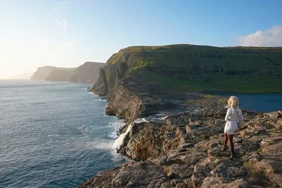
For the best photos, aim for a clear day. The Trælanípa optical illusion needs visibility. Moody fog has its own appeal, but those postcard shots of the lake floating above the ocean need at least some sunshine. Early morning and late evening give you the most dramatic light. Sunset casts a gold glow across the cliffs and the waterfall. Outside the summer window, the trail gets considerably more dangerous, and short winter days leave little room for mistakes.
Is Bøsdalafossur worth it?
The drive to the trailhead alone is a pleasure. You wind through the green valleys of Vágar with glimpses of the sea at every turn. From the moment you park, the landscape feels big and raw but somehow welcoming. The hike to Bøsdalafossur in the Faroe Islands is not the hardest, and the waterfall is not the biggest. But few places on earth mix the elements quite like this: a lake balanced on the edge of a cliff, a waterfall dropping straight into the ocean, and a coastal view that runs unbroken to the horizon.
Come prepared. Pay the fee without overthinking it. Give yourself plenty of time to wander. You will leave with memories, and photos, that make every step feel justified. This is the Faroe Islands at their most stripped-down and unforgettable.